Concept
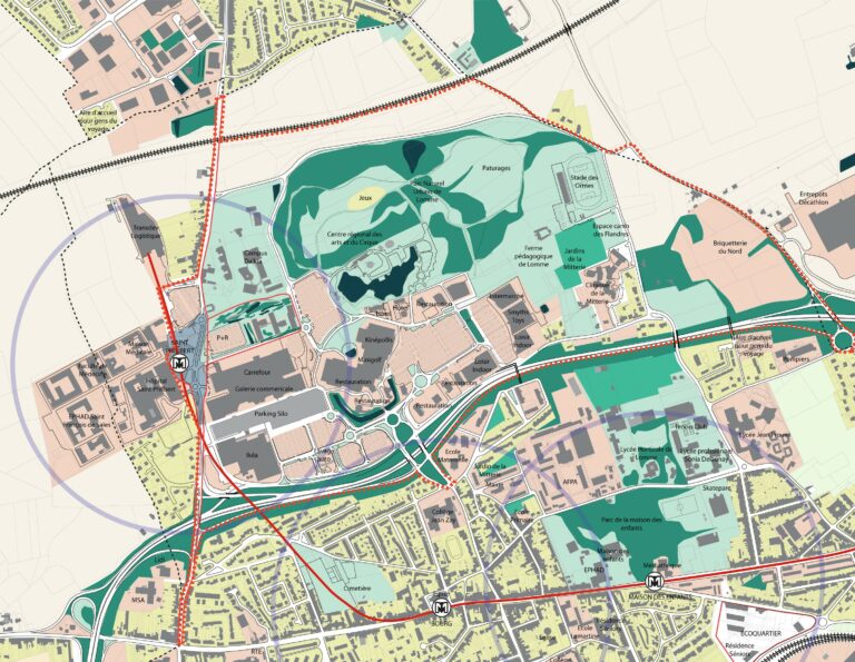
The Algiers Bay Development Project was born out of a strong political desire to make the coastline of Algiers, the capital of Algeria, the driving force behind the development of an attractive Mediterranean eco-metropolis where life is good. This project, led by a multidisciplinary consortium headed by Arte Charpentier, was carried out in conjunction with the development of the SDAU (Master Plan for Development and Urban Planning) for the Wilaya of Algiers in order to define the challenges, objectives, and projects of the SDAU in its coastal section.
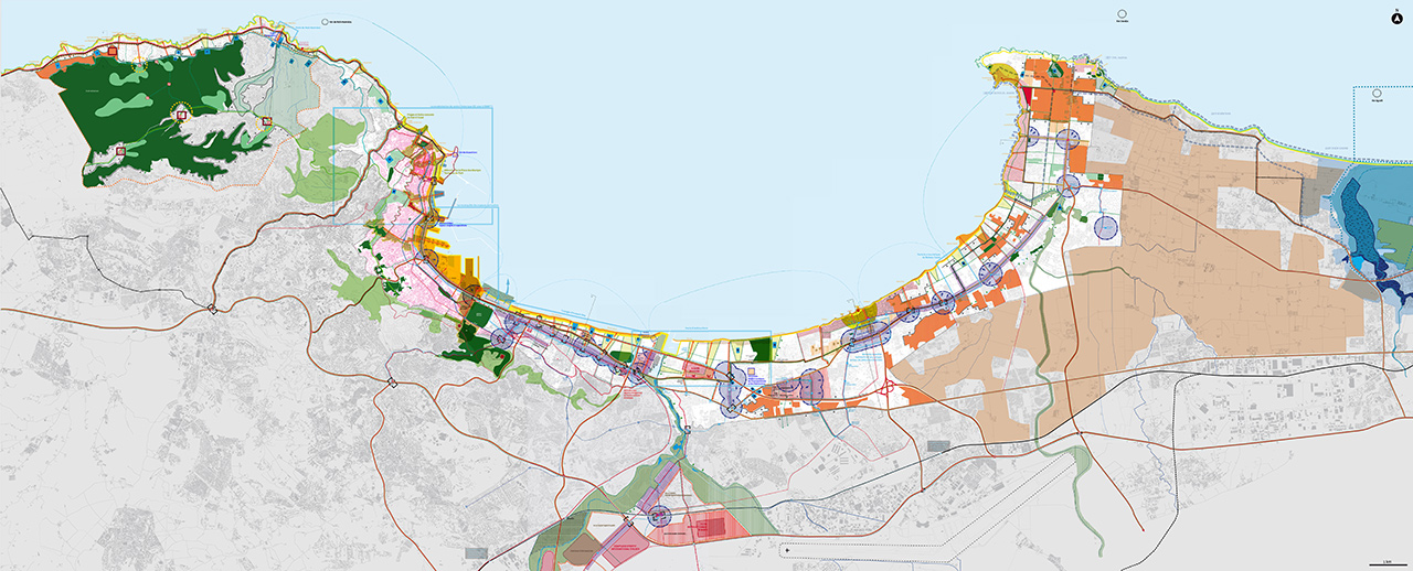
The development plan is based on several key areas:
- reclaiming port areas by relocating industrial and commercial activities to a new deep-water port;
- rebalancing centrality in conjunction with a new structured and hierarchical transport network.
- controlling urban sprawl by reclaiming central areas and large industrial wastelands;
- restructuring the urban fabric by upgrading the historic center and redeveloping contemporary neighborhoods;
- restoring ecological balance and continuity by consolidating large natural and agricultural areas, rehabilitating historic parks and gardens, restoring riverbanks, enhancing landscape features, and developing a coherent network;
- preserving water resources by implementing hierarchical treatment solutions adapted to different types of pollution, with the aim of achieving “zero discharge” into the sea;
- Reclaiming coastal areas by stabilizing the coastline, rehabilitating the dune cordon, consolidating cliff areas, and restoring large sandy beaches;
- Reducing natural and technological risks by implementing new development principles.
The draft development plan has informed a coherence plan whose main spatial principles are:
- The macro road network, a network of major roads, coupled with rail infrastructure: subways, trams, cable cars, aimed at limiting the intrusion of cars into the city.
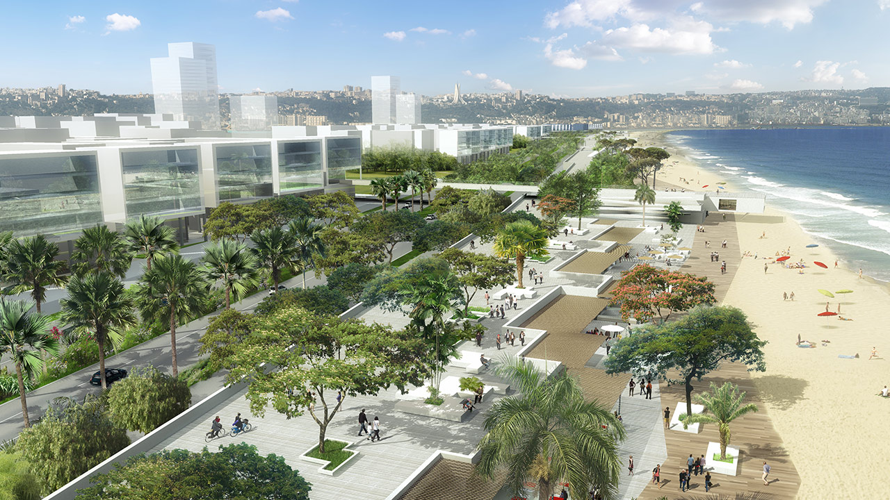
- The string of pearls: where the sea meets the land, at the junction of the macro road network, major facilities are located, forming a string of pearls around the bay. These major facilities, and the accompanying real estate projects, offices, housing, and shops, are the beginning of the development of new neighborhoods. The Grande Promenade
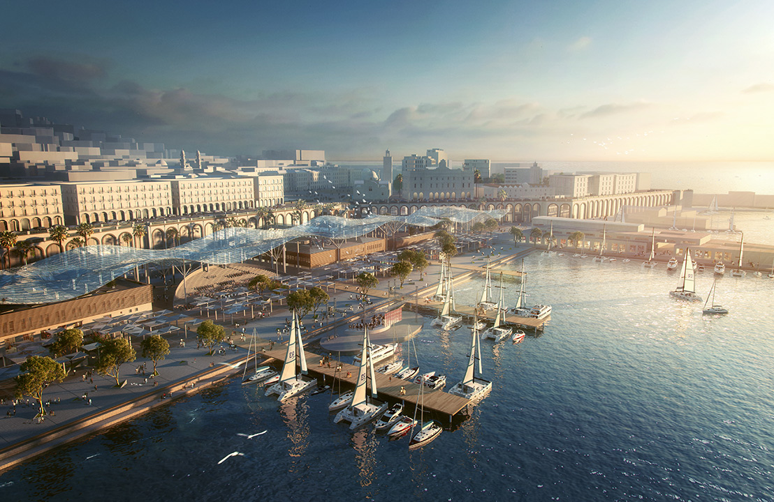
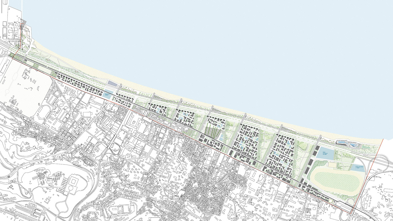
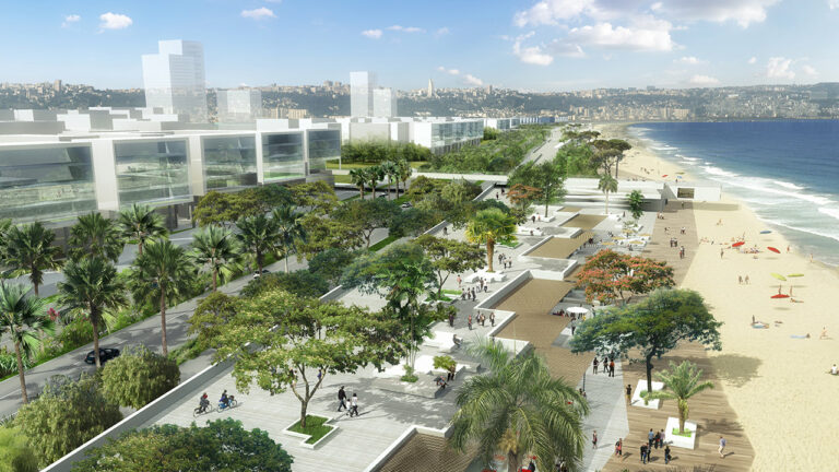
- Algiers Bay: The major facilities are linked together by the Grande Promenade de la Baie d’Alger. It runs from west to east along the entire coastline of the bay. It is primarily a protective structure that stabilizes the coastline and allows beaches to be restored. It is designed as a series of generous public spaces dedicated to pedestrians and soft modes of transport, with planted areas serving as green filters to interrupt the discharge of pollutants into the sea.
- The blue and green plan: a series of voluntary measures contribute to improving water quality, commissioning wastewater treatment plants, creating retention basins, rehabilitating wadis and revegetating their banks, and creating a green filter along the coastline.
- Green windows: this initiative is accompanied by a vigorous policy of creating green spaces, starting with the rehabilitation of the Jardin d’Essais. It continues with the creation of green windows opening onto the sea, expanding to form a green setting for the beaches and the seafront.
- Green lungs: to preserve the environmental, food, and health balance of the metropolis, the rich agricultural lands east of the bay, as far as Lake Réghaia, are being preserved.
This coherence plan was accompanied by detailed sectoral plans and the identification of projects intended to drive development:
- The redevelopment of Bab el Oued’s beaches and natural bathing areas to give Algiers residents access to popular beaches in a well-equipped seaside setting and attractive environment;
- The landscaping of the Eastern Highway into an urban boulevard organized around six landscape sequences and the diversion of traffic to the outskirts;
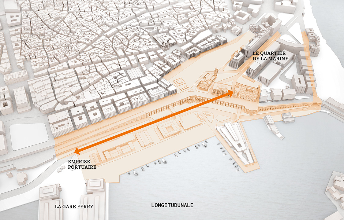
- The development of the Terrasses du Port to open up the city to the port and create a pleasant seaside promenade linked to the Place des Martyrs;
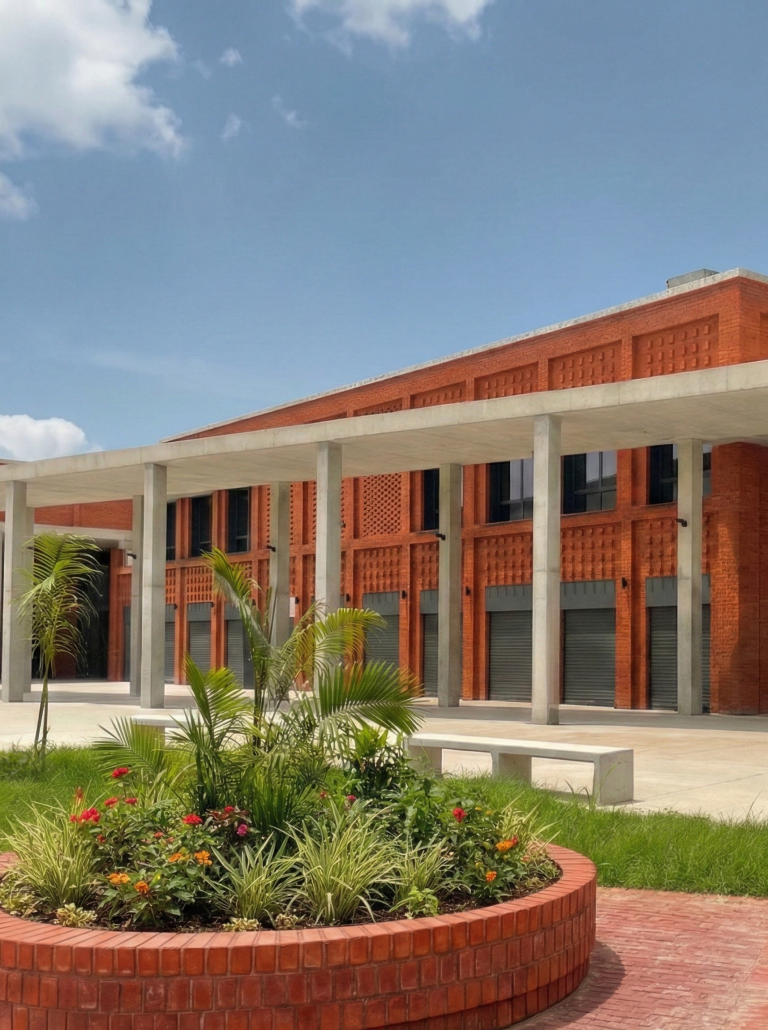
- Tripoli Street – Hussein Dey triangle: a strategic area with major challenges, characterized by the great mutability of its spaces and destined to become the future “gateway” to the historic capital, marking the transition between the Algiers of yesterday and the New Algiers;
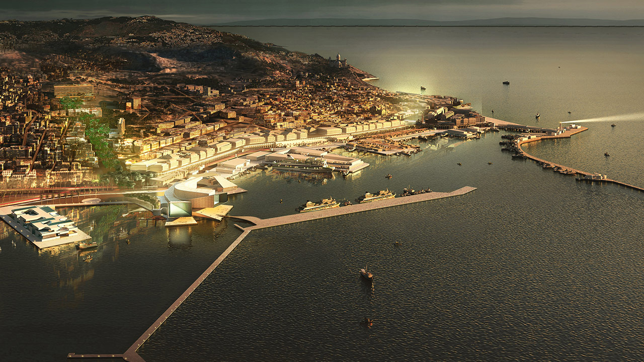
- The reconquest of Oued el Harrach with the renaturalization and redevelopment of its banks and, at its mouth, the positioning of two iconic buildings: the Great Mosque and the Algiers Opera House.
- The extension to the east around the Bateau Cassé sector, where an exemplary project such as an eco-neighborhood could be carried out.
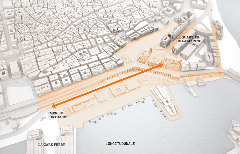
Following these urban considerations on the development of the coastal area of Algiers Bay, as part of the Strategic Plan for the Wilaya of Algiers for 2030, the commercial development project for Place des Martyrs and its immediate surroundings was awarded as a concession to the INJAZAIR Group in association with Arte Charpentier.
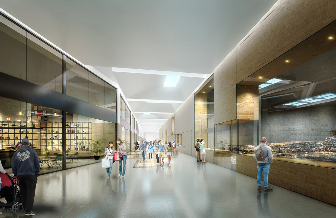
The project aims to revitalize Place des Martyrs and its underground area in connection with the port facilities. The program is focused on leisure, relaxation, commerce, and dining, combining open and semi-open spaces.
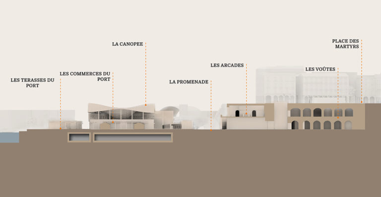
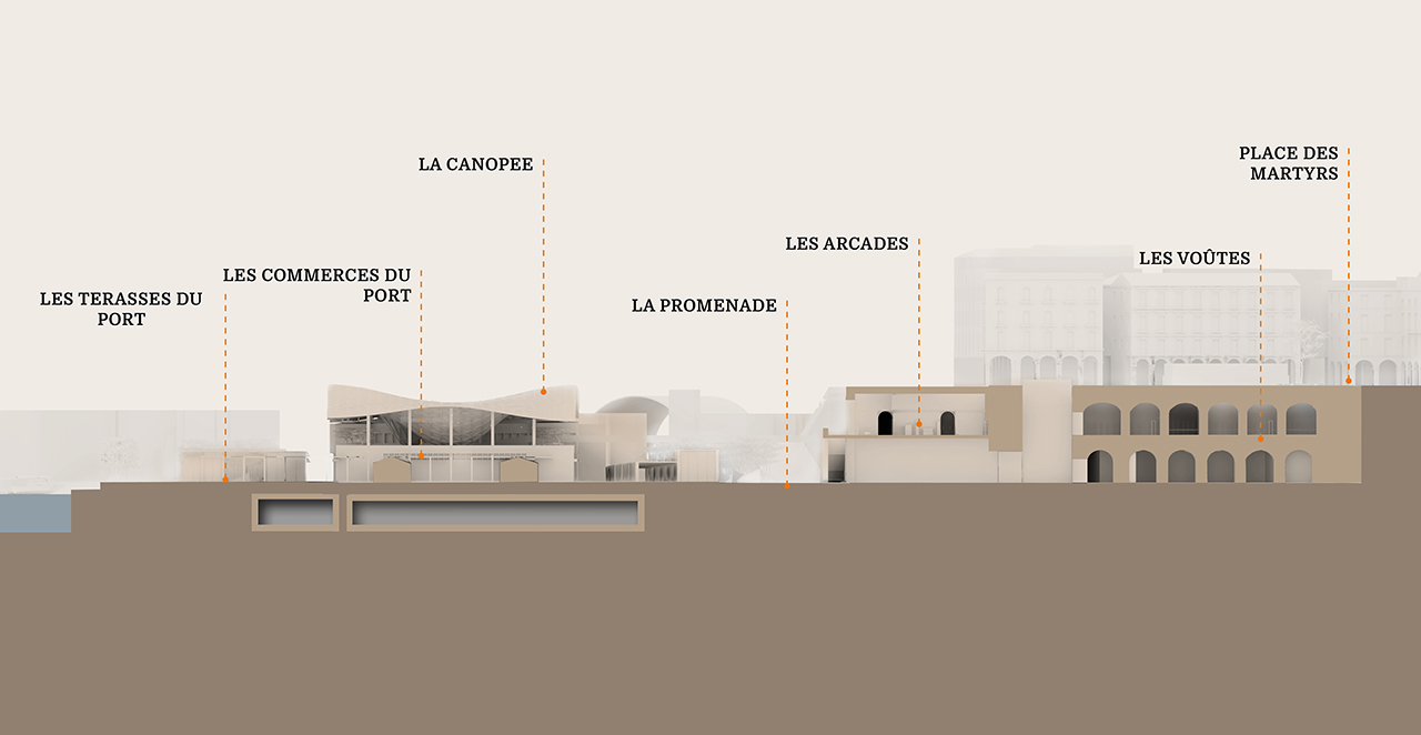
A series of sequences punctuate the project, creating a link between the city, the metro, and the Terrasses du Port:
– The metro-vault sequence emphasizes the site’s archaeological strata by dramatizing the passenger journey, creating an effective link between the underground spaces and the metropolitan transport network.
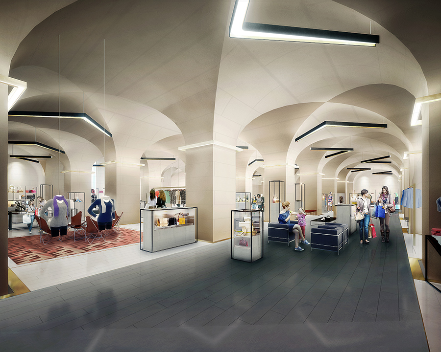
– The vaults are revealed and form a veritable heritage showcase for exclusive shops.
– The balcony arcades on the seafront are reserved for small linear shops on two levels. They offer an active connection to the Terrasses du Port and enjoy a remarkable panorama of the sea.
– The promenade, or “Ramblas d’Alger,” is designed as a true public space. This transitional area between the seafront and the Terrasses du Port is a place for urban interaction, ideal for strolling, where permanent and temporary shops will be located.
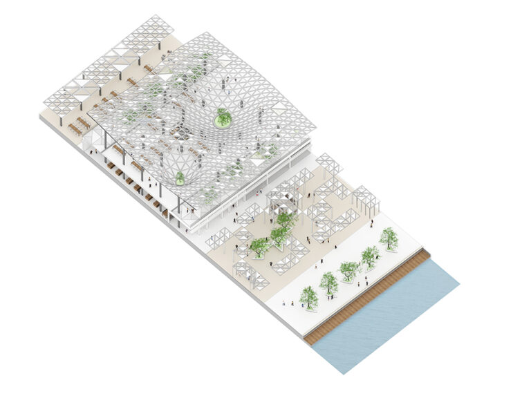
– The Terrasses du Port are designed as a new destination that could become a favorite meeting place for Algiers residents, offering a variety of cultural and commercial activities. Its rooftops will make it the capital’s new must-see location. It will house more than 150 shops (small and medium-sized).
– The Canopy is a unifying and iconic element, designed as a protective veil or a genuine invitation to travel; it is intended to be a symbol of the modernity breathed into the Old Port of Algiers.
The expressway will be diverted by creating an underground passage between the arcades and the port to allow pedestrians to reclaim this area, which is currently inaccessible to Algiers residents.
The project thus places emphasis on enhancing the built heritage and landscape, which are an important part of the area, in order to preserve its image and identity while promoting high-quality contemporary architecture.
Team
Contracting authority
– Project owner: Wilaya of Algiers, Department of Land Use Planning, Urban Planning, Prevention, and Slum Clearance
Project management
– Lead architect: Arte Charpentier
– Partners Baie d’Alger: CATRAM Consultants / PHYTORESTORE / PLANETH Consultants / Laboratoire d’Etudes Maritimes (LEM) / Partenaires Développement / B&Bing
– Place des Martyrs partners: CAP – Chabou Architectes & Partenaires
Specificities
– Project address: Bay of Algiers – Algeria
– Surface area: 110 km²
Image credits: Arte Charpentier, Franck Pan