


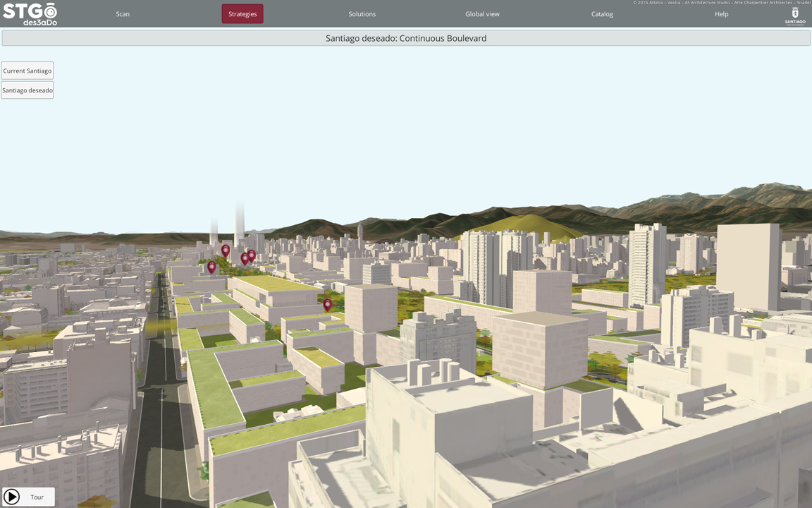
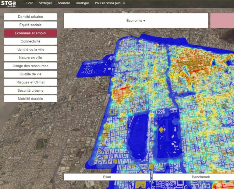
Santiago deseado 3D Simulator
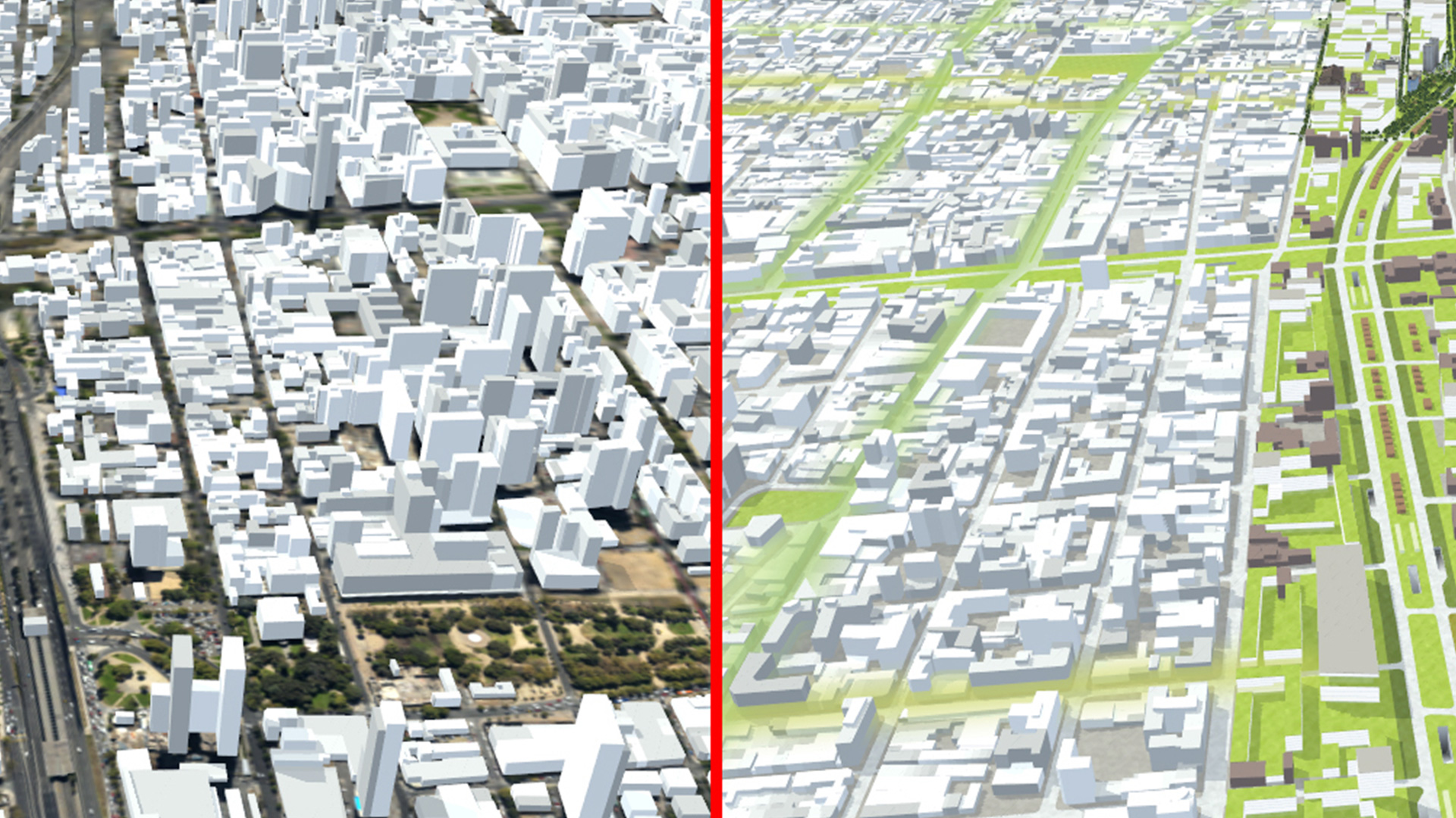
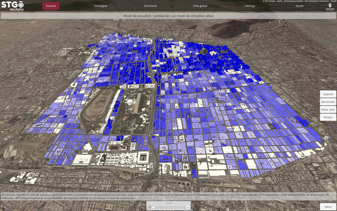
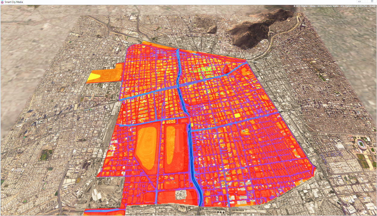
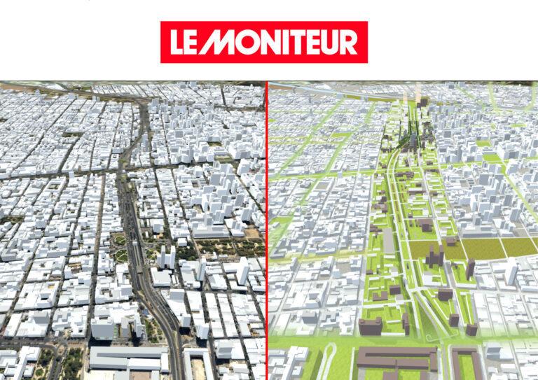
Based on an urban planning study, a consortium of French companies has developed a 3D simulator of the sustainable city of the future for the city of Santiago in Chile. This decision-making tool makes it possible to visualise the impacts of a possible coverage of the Autopista Norte-Sur, an urban highway which currently constitutes a major urban spatial divide that the Municipality would like to mitigate.
Informations
| Type of project | Urban planning study |
| Programme | Computing tool |
| Contracting authority | Ministry of Economy and Finance |
| Architect | Arte Charpentier |
| Location | Santiago, Chile |
| Completion date | 2015 |
| Surface area | Study: 350ha, Masterplan : 23km² |
| Partner architect | Architecture-Studio |
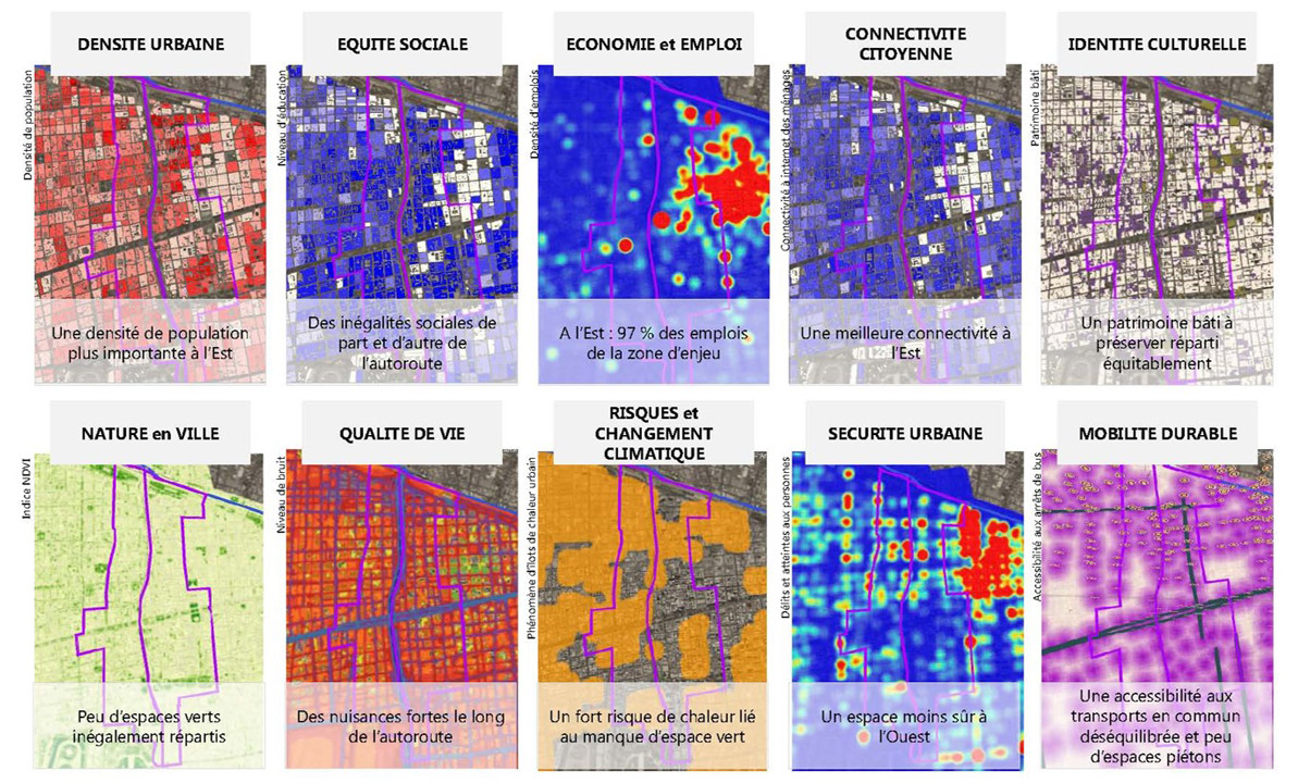
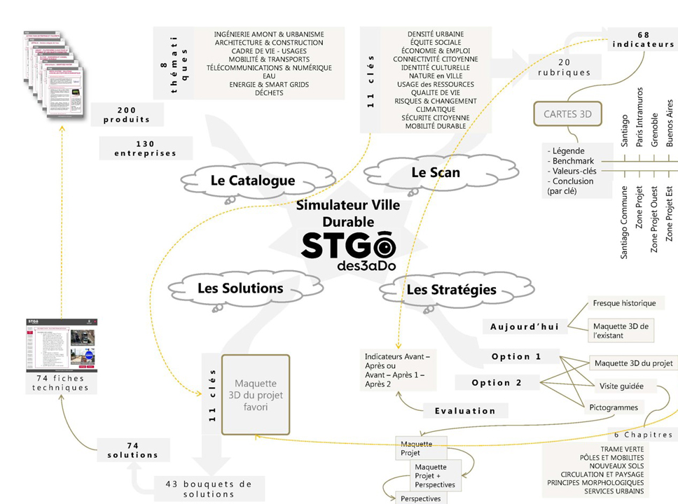
Santiago deseado is a unifying tool combining a global vision of objectives and targeted thematic and geographical actions.
Antonio Frausto, associate architect / Arte Charpentier

Voir d’autres contenus :
Simulateur 3D pour la ville durable de Santiago du Chili
06 February 2014
Séminaire FASEP au Chili
06 February 2014
Testez le démonstrateur de ville durable
06 October 2016

Les Echos : Une vitrine numérique sur la ville durable …
15 January 2015

MIPIM 2014
13 February 2014

La démarche ISO 9001, l’Architecture et Arte Charpentier
15 September 2021
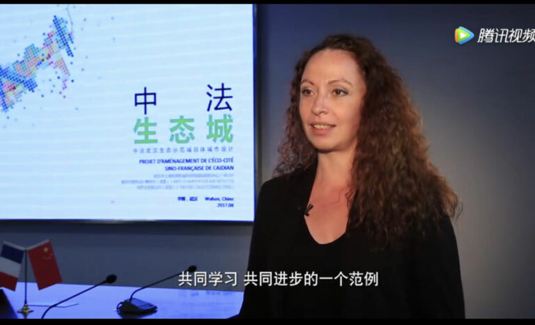
Marie-France Bouet, directrice du pôle urbanisme, interwiewée par la TV chinoise
21 September 2017
M.A.P Mouvements Architectures Pluriels
07 May 2013