

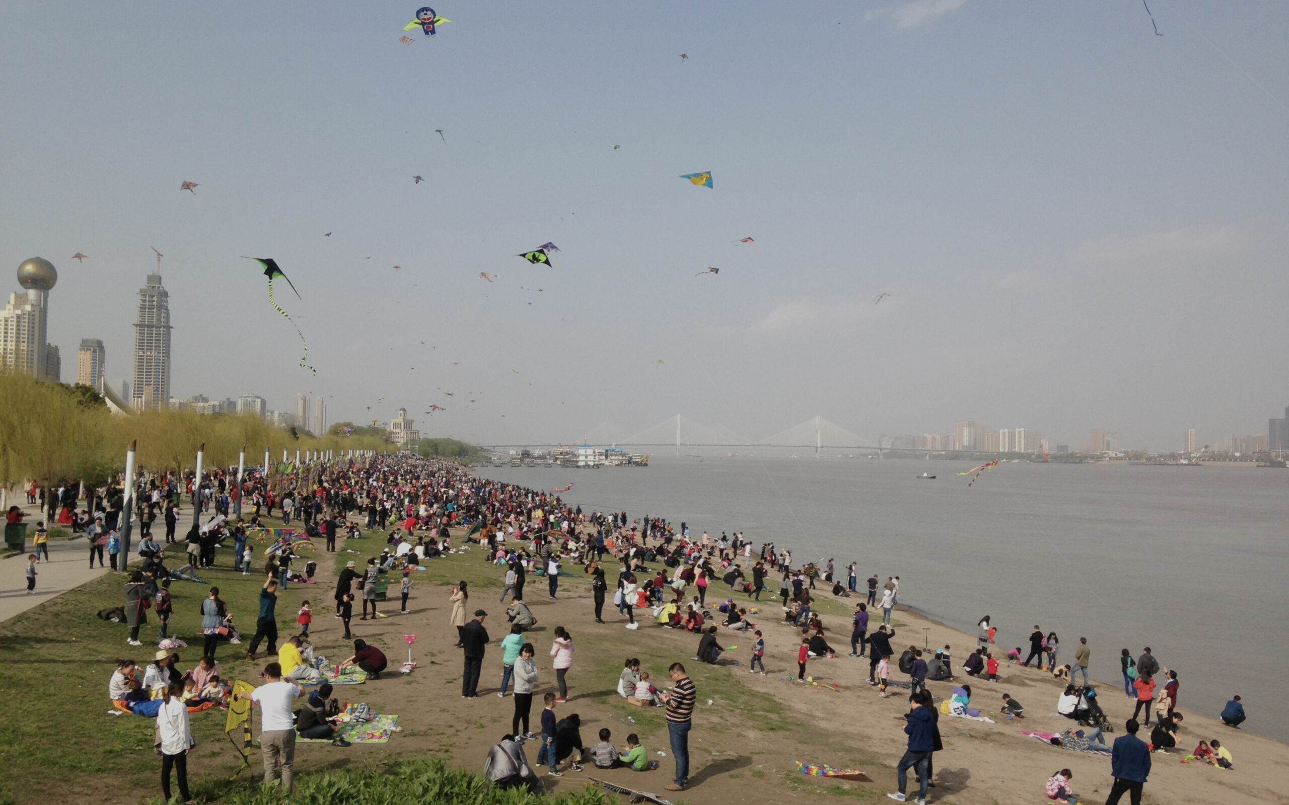
Georgina André, a researcher and urban planner at the agency, tells us about her geography thesis by decoding an image of Wuhan every 15 days.
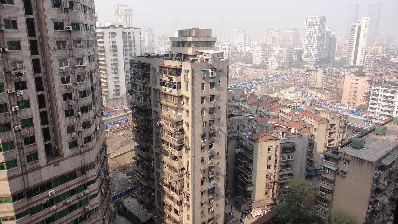
“This image is the cover photograph of my manuscript: it is taken from the first apartment which I lived in for a few months in Wuhan in 2016, on the left bank of the Yangtze River in Hankou. It reflects the contradiction facing the Wuhan Municipality: it wants to form a modern, ambitious metropolis, connected and integrated by rapid transport networks. But this movement of the large industrial city towards its metropolitan design leads to more fragmentation of the urban fabric: in this photograph, we see the trenches of the metro system under construction in Sanyang Street, and the heterogeneity of the buildings. This heterogeneity, placed in the urban space with no real seam between the different strata of urban planning, shows us the history of development in Wuhan up to the modern and contemporary city that makes up the background of the photograph.
This ephemeral period of the metropolitan transition may reach a certain maturity in a few years. But rather than evaluate the success of this strategy, it seemed to me much more interesting to study how this transition is implemented and staged: it tells us something about the urban trajectory of Wuhan, which aspires to be a city that is “different every day” (meitian bu yiyang!).”
To learn more about Georgina André’s thesis, please see the news item: Wuhan, a geographer’s perspective